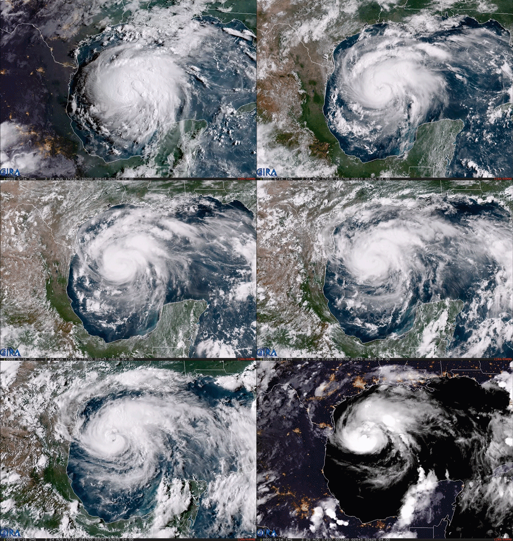
This imagery captured by NOAA’s GOES-16 satellite yesterday depicts Harvey as it regained hurricane status over the Gulf of Mexico. It is now a major Category 4 cyclone bearing down on the Texas coast and all forecasts indicate it will be a devastating natural disaster. Torrential rainfall is predicted across much of central and eastern Texas, with some estimates as high as three feet of precipitation over the next week.
GOES-16 is the first of the next generation of geosynchronous environmental satellites jointly operated by NASA and NOAA that will provide atmospheric and surface measurements of the Earth. Data from the GOES system is used for weather forecasting, severe storm tracking, space weather monitoring, and meteorological research.
The forecasting efforts of NOAA’s National Weather Service have saved countless lives over its many years of existence and our country’s continued investment into its efforts will protect many more.
To anyone in the path of the storm, please stay safe and heed the directions of your local authorities.
Godspeed Texas.
Source: https://goo.gl/Ney4Xs (NOAA)
#ScienceGIF #Science #GIF #Hurricane #Harvey #GulfOfMexico #Gulf #Texas #Mexico #Tropical #Storm #NOAA #NASA #Satellite #GOES16 #Geocolor #Geosynchronous #Climate #Weather #Meteorology View Original Post on Google+

