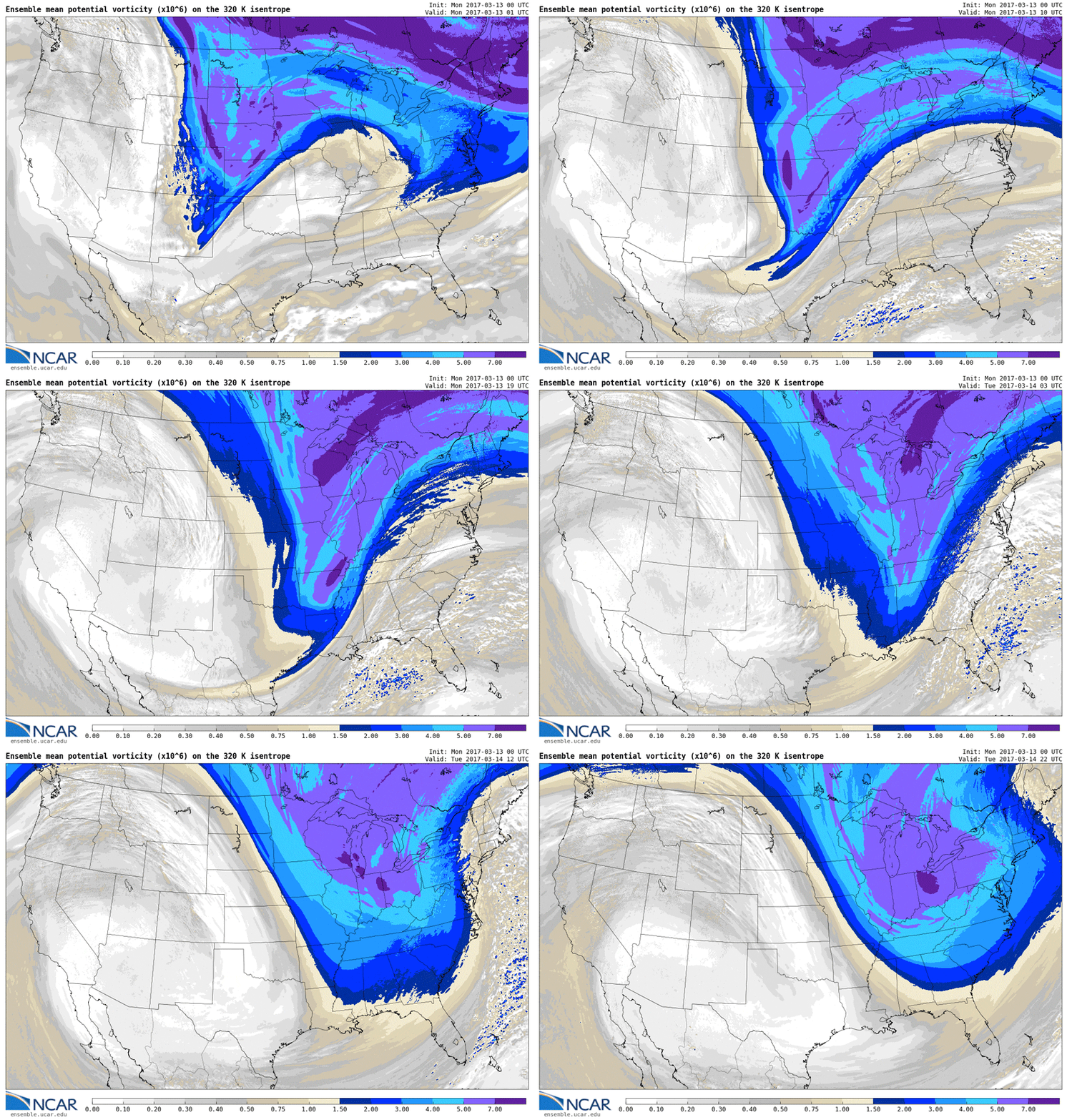
The northeastern United States is currently bracing for record-breaking snowfall as a Nor ‘easter approaches the region. This macro-scale cyclone is a cold-core low-pressure system that thrives on cold air, opposite to how a hurricane thrives on warm air. Nor’easters form as warm Gulf Stream ocean current coming up from the tropical Atlantic collides with cold air coming down from Canada to form an area of intense low pressure.
These weather maps from the National Center for Atmospheric Research (NCAR) depict a measurement known as potential vorticity , which is a useful metric for studying the formation and development of cyclones (cyclogenesis). Much like angular momentum, atmospheric potential vorticity must also be conserved in a system. Therefore, when a broadly spread vortex of air converges, its airspeed must increase in order to maintain potential vorticity.
Source: http://www.ensemble.ucar.edu/index.php (NCAR)
#ScienceGIF #Science #GIF #Weather #Forecast #NCAR #NSF #Meteorology #Climate #Vorticity #Forecast #Noreaster #Northeaster #NYC #Boston #Snow #Blizzard #Cyclone #Atmosphere #Research #GulfStream #Cyclone View Original Post on Google+

