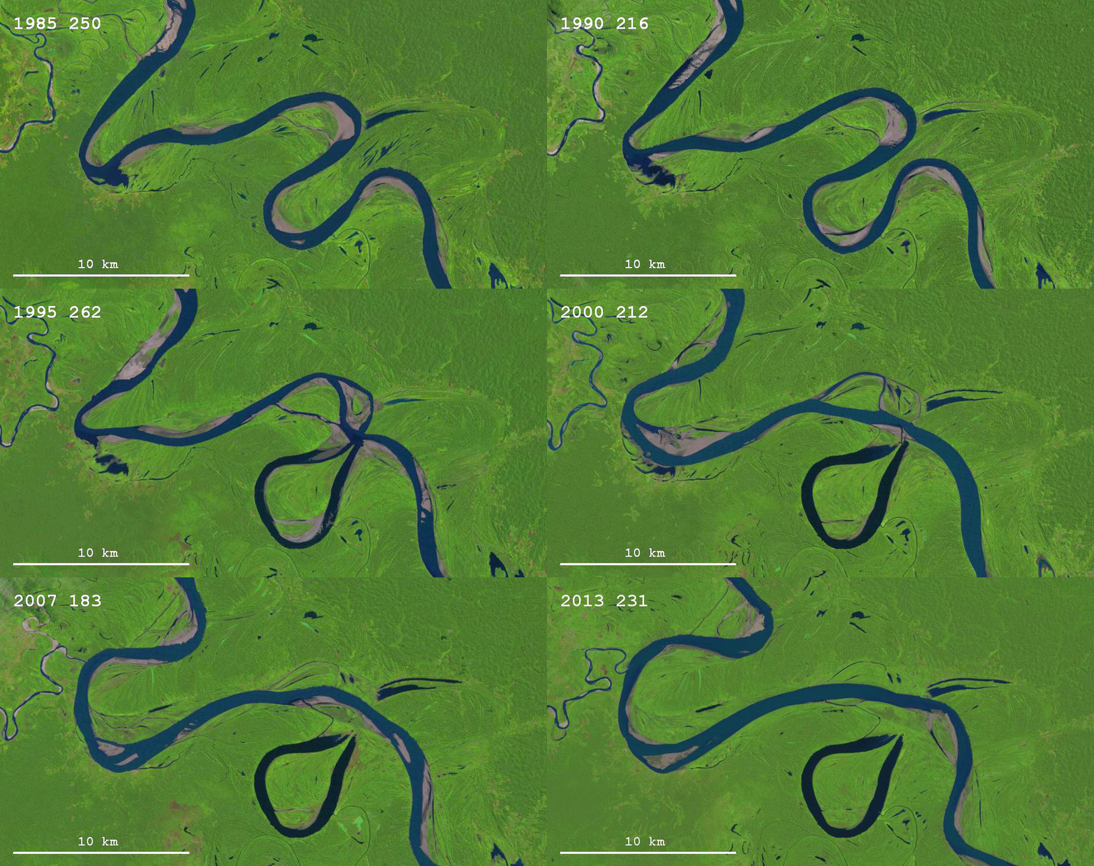
The Landsat program is the longest-running enterprise dedicated to the acquisition of satellite imagery of Earth. Google’s Earth Engine combines this multi-petabyte collection of satellite imagery and geospatial datasets with planetary-scale analysis capabilities to facilitate study of our home planet.
This timelapse of satellite images depicts the evolution of the Ucayali River in Peru between 1985 and 2013. The tight bend on the bottom of the imagery undergoes a neck cutoff as the river cuts straight across the landscape. The development of sand bars can also be seen downstream around the large bend.
Source: http://goo.gl/F0LWZV
#ScienceGIF #Science #GIF #Satellite #Earth #GoogleEarth #Landsat #GoogleEarthEngine #River #UcayaliRiver #River #Ucayali #Peru #Bend View Original Post on Google+

